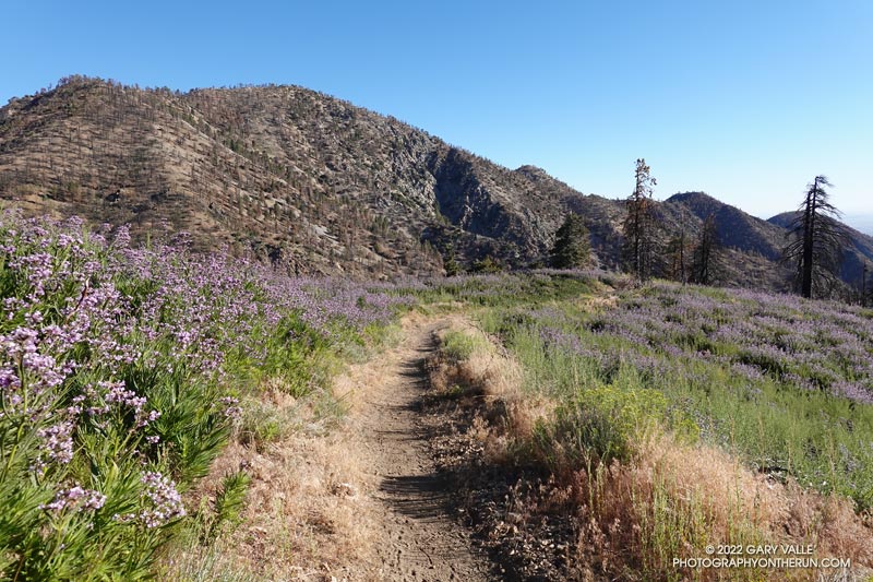
Poodle-dog Bush along the Pacific Crest Trail near Islip Saddle with Mt. Williamson in the background.
Nope, my eyes weren’t deceiving me, the hiker was carrying his full-size poodle up the trail.
I was running down the PCT, east of Islip Saddle, after a run/hike to Mt. Hawkins and Throop Peak. I’m guessing the hiker was carrying his dog to keep it out of the Poodle-dog Bush on both sides of the trail.
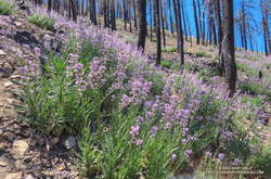
Poodle-dog bush along the PCT above Islip Saddle
Poodle-dog Bush (Eriodictyon parryi) is a fire-follower that can cause severe dermatitis in some people. In this case the plants sprouted following the 2020 Bobcat Fire.
The last big outbreak of Poodle-dog Bush followed the 2009 Station Fire. At that time many people were unfamiliar with its potential effects, and were caught off-guard.
The plant can get you in a couple of ways — the plant’s resin can affect sensitized people in a manner similar to poison oak, and the plant’s numerous hairs can break off and irritate the skin.
Flower stalks of bleeding heart on the Chamberlain segment of the Backbone Trail
After climbing the western ridge route on Boney Mountain and scrambling over Tri Peaks, I was trying to run down the Chamberlain segment of the Backbone Trail. Usually one of my favorite downhills, the trail was so glutted with the flower stalks of bleeding heart, it made running difficult. Here’s a video snapshot of one short section of trail.
During this second Spring following the Woolsey Fire, bleeding heart has become a predominant fire follower in the Boney Mountain Wilderness. Its rampant growth is reminiscent of the explosion of Poodle-dog bush in the San Gabriel Mountains the second Spring following the 2009 Station Fire.
Poodle-dog bush near the top of the Mt. Wilson Trail. June 15, 2019.
The Mt. Wilson – Chantry Flat loop is a favorite that I run a couple times a year. Including a little bonus mileage to get to the Mt. Wilson parking lot before the gate opens, the run is about 18 miles long and gains/loses about 4500′ of elevation. The main trails in the loop are the Rim Trail, Gabrielino Trail, Upper Winter Creek Trail and Mt. Wilson Trail.
The weather was perfect for today’s run. Sunny at the beginning, then partly cloudy for the 4000′ climb from the “green bridge” below Chantry to the parking lot on Mt. Wilson. Although there was a lot of poison oak on the Rim and Gabrielino Trails, it was mostly avoidable. About 30 minutes into the run, I was surprised to hear the unmistakable gobble and rustling of a wild turkey high on the Rim Trail.
Near the end of the loop, on the section of the Mt. Wilson Trail above the Mt. Wilson Toll Road, I saw two solo hikers brush against new, vigorously growing patches of Poodle-dog bush (Eriodictyon parryi). I spoke to them, and they were unaware that, like poison oak, Poodle-dog bush can cause an itchy rash. Some people don’t react at all to the plant and others can have a severe reaction. My own experience is described in this post.
Poodle-dog bush is a fire follower that grows in the San Gabriel Mountains, and some other areas. It became very widespread following the 2009 Station Fire. There are still some diminishing patches of Poodle-dog bush on the north side of Mt. Wilson (and elsewhere) from the Station Fire, but the Poodle-dog bush on this part of the Mt. Wilson Trail is a result of the 2017 Mt. Wilson Fire.
Fire followers are plants that grow in a recently burned area in much larger numbers than before a fire. In some cases the species may rarely have been observed in the area prior to the fire.
A good example of a fire follower is Poodle-dog bush (Eriodictyon parryi), which became widespread in the San Gabriel Mountains following the 2009 Station Fire.
A wet rain season also increases the population of many species. Combine a fire and wet rain season and plant distributions and populations can be dramatically altered.
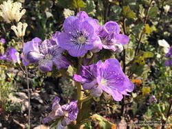
Large-flowered Phacelia near Tri Peaks. Click for larger image.
Yesterday, I did a long run in the Santa Monica Mountains that included several miles of the Backbone Trail between Sandstone Peak and the Danielson Multi-use area in Sycamore Canyon. This area was burned in 2018 Woolsey Fire and there were some stunning displays of fire followers and other wildflowers.
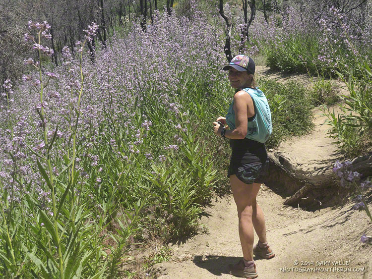
Star lily was one of the earliest fire followers to bloom in the area and remains prevalent, but the champion fire follower at the moment is large-flowered Phacelia. Before the Woolsey Fire it would be unusual to see this plant on this section of the Backbone Trail. Now its purple-blue flowers blanket large areas along the trail.
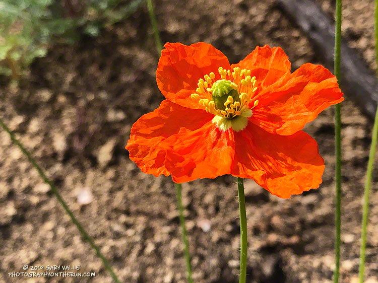
Although not as numerous as the large-flowered Phacelia, I’ve never seen so many fire poppies along the Backbone Trail. Its orange-red color is striking and stands out sharply against the brown, charcoal-infused soil. Also more abundant this year is the vibrant yellow collarless poppy.
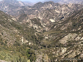
It’s been nine years since the Station Fire burned 160,577 acres in Angeles National Forest. The Red Box – Bear Canyon – Gabrielino loop is a long time favorite adventure run that I’ve enjoyed doing many years before and after that 2009 fire.
The loop was the first I did when the area reopened in May 2011. The trails were in poor shape — overgrown and damaged from flash floods. The notorious fire-follower Poodle-dog bush had flourished in the wake of the fire and was particularly bad along the Gabrielino Trail between Switzer’s and Red Box. Thinking I was “immune” to the plant, I brazenly plowed through it, and as a result spent several inflamed nights trying to sleep in a reclining chair.
Each year Bear Canyon and upper Arroyo Seco recover a little more. Poodle-dog bush is in decline and in many areas nearing the end of its life-cycle. The chaparral, bay trees and oaks are all recovering; and the bigcone Douglas-firs that survived the fire have become more fully-foliaged.
Bear Canyon from the upper Bear Canyon Trail. Click for larger image.
This year Bear Canyon was a little drier than last. The creek was a trickle, disappearing in the sand in some areas and creating small pools in others. The path in the upper part of the canyon, above Bear Canyon Camp, was better defined, but still tricky to follow in some spots.
With the dry conditions, most of the poison oak had already turned red. It was easy to spot, but difficult to avoid. The “stinging nettle” creek crossing higher in the canyon wasn’t as overgrown as last year, but I still managed to brush against a plant or two.
Bear Canyon ends at Arroyo Seco, downstream of Switzer Falls. After turning upstream on the Bear Canyon Trail, I hadn’t run far when I encountered a couple of mountain bikers. They asked me, “is this the trail to JPL?”
This wasn’t the first time that I’d encountered misplaced riders or hikers on this section of trail. Some get misplaced looking for the falls and others mistakenly follow the Bear Canyon Trail down into Arroyo Seco instead of continuing high in the canyon on the Gabrielino Trail. Because of the completion of the restoration of the Gabrielino Trail there were a few more riders on the trail than usual.
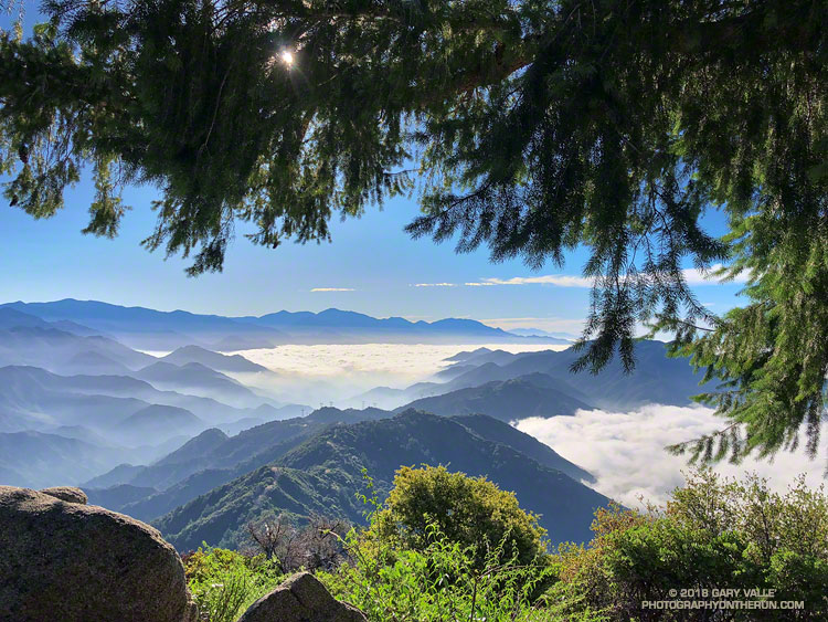
This morning’s run from Mt. Wilson started with striking views of the Southern California’s mountains from the Rim Trail. An extensive marine layer heightened the contrast between the highlands and the lowlands, with peaks such as Mt. Baden-Powell, Mt. Baldy and Monrovia Peak standing starkly above the ocean of clouds. Beyond Mt. Baldy, San Gorgonio Mountain could be seen, more than 75 miles distant.
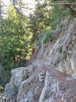
A section of the Rim Trail between Mt. Wilson and Newcomb Pass.
The Rim Trail connects Mt. Wilson (5710′) to Newcomb Pass (~4100′). A trail and firebreak between Mt. Wilson and Newcomb Pass are shown in the 1934 “Advance Sheet” for the the first USGS 1:24000 map of the area, the Mt. Wilson Quadrangle. The route of the trail depicted in the finalized 1939 edition of the map is essentially the same as the Rim Trail today.
The somewhat primitive and adventurous character of the Rim Trail makes it a favorite. Most often I run the Rim Trail as the first leg of a loop that follows the Gabrielino Trail down to Chantry Flat and then returns to Mt. Wilson on the Upper Winter Creek and Mt. Wilson Trails.
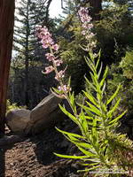
Poodle-dog bush .
There is still some Poodle-dog bush along the Rim Trail and also on the connector trail between the top of the Kenyon Devore Trail and the Mt. Wilson Trail parking lot. As long as you see it, it is easily avoided. Poodle-dog bush is a fire-follower — in this case from the 2009 Station Fire — that can cause contact dermatitis. Here’s a closer look at the flowers.
Today, instead of turning right at Newcomb Pass toward Chantry Flat, I turned left on the Gabrielino Trail, . This leads down to Devore Camp — an isolated trail camp along the W.F. San Gabriel River. (Think creek!) From Devore Camp the Gabrielino Trail is followed up-canyon to West Fork Camp and then to the Kenyon Devore Trail. The Kenyon Devore Trail is then used to get back up to Mt. Wilson. There are other variations as well.
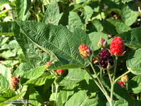
Blackberry along the Gabrielino Trail
While the Gabrielino Trail between Spruce Grove and Chantry Flat is one of the most used in the range, the Gabrielino Trail between Newcomb Pass and West Fork is a rustic trail that sees far less use. On previous outings, I had not seen anyone on this segment of the trail. Today, I was surprised to find a backpacker at Devore Camp. I had to laugh when the first thing he said was, “Man, there is a lot of poison oak around here!”