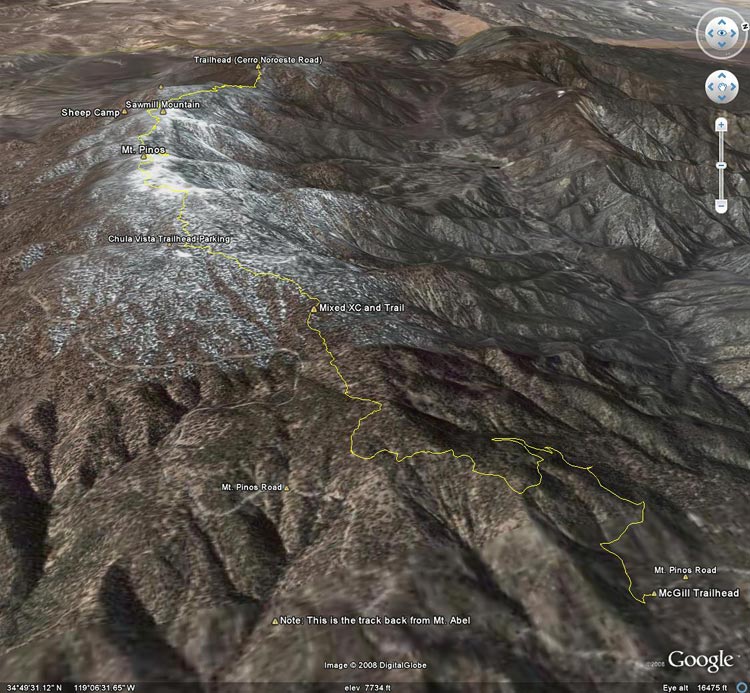
Google Earth image of the route from the Lower McGill trailhead over Mt. Pinos to Mt. Abel and back
 alt="Google Earth image of the route from the Lower McGill trailhead over Mt. Pinos to Mt. Abel and back" border="0">
Google Earth image of the route from the Lower McGill trailhead over Mt. Pinos to Mt. Abel and back
Click this link to read more about this photograph.
Click on any of the following categories to see additional photography:
ABSTRACT - QUIRKY - LANDSCAPE - WILDLIFE - INSECTS - WILDFLOWERS - ADVENTURES
PHOTOGRAPHY
ON THE RUN
Copyright © 1995-2024 Gary Valle'. All Rights Reserved.
![]()