Google Earth image of the summit area of Calabasas Peak. and the GPS trace of my route up and down
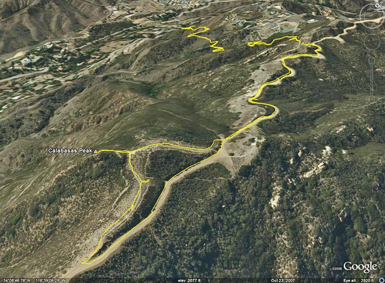 alt="Google Earth image of the summit area of Calabasas Peak. and the GPS trace of my route up and down the peak." border="0">
Google Earth image of the summit area of Calabasas Peak. and the GPS trace of my route up and down the peak.
Click on any of the following categories to see additional photography:
ABSTRACT - QUIRKY - LANDSCAPE - WILDLIFE - INSECTS - WILDFLOWERS - ADVENTURES
PHOTOGRAPHY
ON THE RUN
Copyright © 1995-2024 Gary Valle'. All Rights Reserved.
![]()