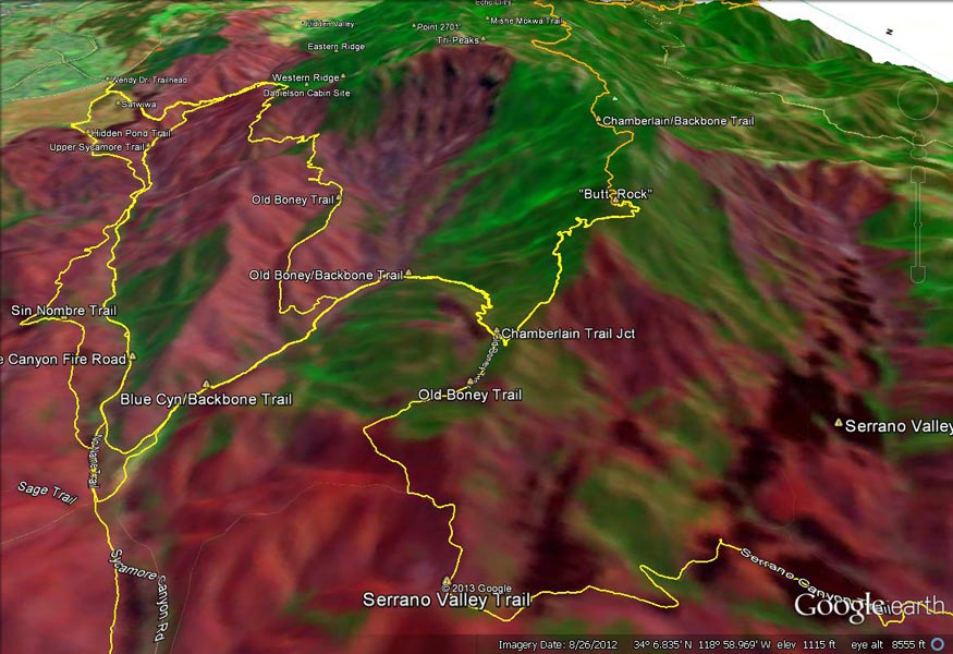
A Google Earth overlay of a NASA Landsat image of Springs Fire burn severity in the vicinity of the
 alt="A Google Earth overlay of a NASA Landsat image of Springs Fire burn severity in the vicinity of the Chamberlain Trail." border="0">
A Google Earth overlay of a NASA Landsat image of Springs Fire burn severity in the vicinity of the Chamberlain Trail.
Click this link to read more about this photograph.
Click on any of the following categories to see additional photography:
ABSTRACT - QUIRKY - LANDSCAPE - WILDLIFE - INSECTS - WILDFLOWERS - ADVENTURES
PHOTOGRAPHY
ON THE RUN
Copyright © 1995-2024 Gary Valle'. All Rights Reserved.
![]()